


Understanding the Rules Behind Amelia Wharf’s Height and View Corridor Debate
The recent Historic District Council vote on the Amelia Wharf proposal has left many people wondering why the city insists on elevating buildings so high above the river and then limiting how tall they can rise. It is easy to look at a proposed structure and see only the bulk. The underlying requirements, though, come from a mix of flood safety rules and deliberate community design standards that have been in place for years.
Floodplain regulations drive the elevation. Properties along this stretch of the Amelia River sit in a high-risk coastal flood zone. Building codes and federal insurance rules require the first occupied floor to sit well above the base flood elevation so that people and businesses are not routinely underwater during storms. On this particular site that means the usable floor starts roughly sixteen feet above existing grade. Once that elevation is locked in, the remaining height available for the structure is measured from the base flood elevation upward, not from the ground. The Community
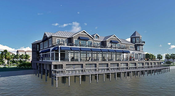
Redevelopment Area standards then cap that measurement at thirty feet to the top of the roof. The combination produces a building that looks tall from the street even when it stays within the numerical limit. The observation tower on the current design pushed past the allowable exceptions for ornamental features, which is one reason the design did not clear the board.
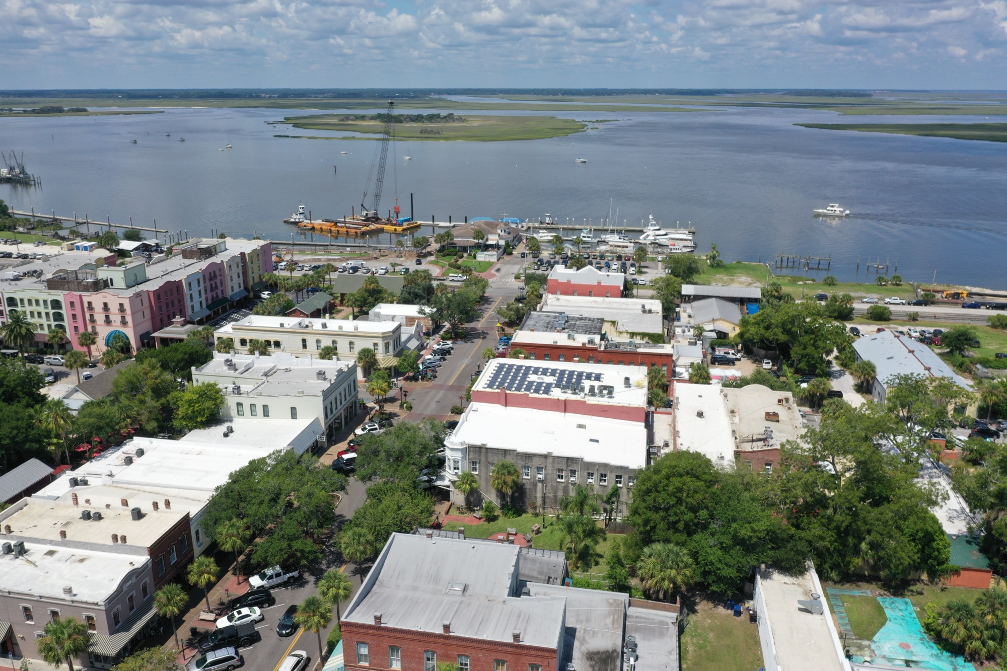
View corridors exist for a different but related reason. The river is not just a backdrop; it is a public asset. The standards require open side setbacks—generally fifteen feet on each side for waterfront lots north of Centre Street—kept clear to the sky. Those gaps prevent a continuous wall of buildings from sealing off the water from streets, sidewalks, and public spaces. They keep the working-waterfront character visible and accessible rather than privatized. When a building stretches too wide or too high across those corridors, the public connection to the river is diminished. That is why the board kept returning to questions of massing and scale even after the applicant made revisions.
Consistent enforcement of these rules matters more than any single project. Property owners and developers need to know the standards will be applied the same way to the next proposal and the one after that. Selective exceptions create precedent that slowly erodes the character the guidelines were written to protect. Residents who participated in earlier planning processes expected the height and view protections to hold. When the Historic District Council applies the adopted Land Development Code and design guidelines evenly, it preserves both predictability for investment and the long-term visual and functional quality of the waterfront. Inconsistent application invites exactly the kind of ad-hoc decisions that leave everyone guessing what the next project will look like.
The flood elevation and height limits are not arbitrary obstacles. They are the practical result of building in a place that floods and of choosing, as a community, to keep the river visible and the scale of new construction in proportion to what already exists. Whether this particular design can be adjusted to meet those standards remains to be seen. The standards themselves, however, exist for clear reasons that go beyond any one application.


Based on the elevation drawing (HDC2026-0021) and Fernandina Beach’s adopted rules, here is a clear picture of what can realistically be built at 0 Front Street under current standards.
The hard numbers from the drawing and the code
The elevation sheet sets Base Flood Elevation (BFE) at 0′-0″ for reference. Key heights above BFE are:
• Street / boardwalk level: 12′-4″
• Second floor: 25′-0″
• Third floor: 36′-8″
• Top of main roof: 47′-6″
• Top of cupola: 61′-0″
Local CRA waterfront standards (LDC Chapter 8 and the CRA Design Guidelines) measure building height from BFE to the top of the roof and cap it at 30 feet. Limited exceptions exist for mechanical screening, elevator overruns, and certain ornamental features, but those exceptions are narrow. A 47′-6″ main roof and 61′ cupola are well beyond what is allowed.
State and federal flood rules require the first occupied floor to sit above the design flood elevation (plus freeboard). That is why the building is lifted on pilings with an open lower level — that elevation is non-negotiable for safety and insurance.
What a code-compliant building could look like
A design that stayed inside the rules would have to compress significantly:
1. Height envelope
• Main roof no higher than roughly 30′ above BFE (possibly a few extra feet for allowed parapet or screening).
• Any cupola or tower feature would have to be much smaller and truly ornamental — not a full observation room that pushes the height to 61′.
2. Number of floors
• The second floor at 25′ above BFE is already close to the limit. A full third floor at 36′-8″ is not feasible under the 30′ cap.
• Practical result: one fully occupied main level plus a partial upper level or mezzanine, or a single tall main floor with roof decks. Two full occupied stories above the elevated base is difficult without exceeding the height limit.
3. Massing and view corridors
• 15-foot open-to-the-sky view corridors on each side (for water lots north of Centre Street) must remain clear.
• The building would need to be narrower or broken into smaller volumes so it does not form a continuous wall across the riverfront.
• Overall bulk would have to feel closer in scale to existing waterfront structures rather than the large, continuous form shown in the rendering.
4. Lower level
• The open undercroft for parking, storage, or floodable space would remain — that is driven by flood elevation requirements and is expected.
Bottom line
Under the current combination of state flood elevation rules and Fernandina’s 30-foot-above-BFE height limit, the structure that can be built is substantially lower and less massive than the design shown. Expect something closer to a one-and-a-half or two-level building (counting from the elevated floor), with the main roof kept near or under 30′ above BFE, a much reduced or eliminated cupola, and clear side view corridors.
The large continuous massing and 61′ cupola in the submitted drawings are the primary reasons the Historic District Council withheld conceptual approval. A redesign that respects the 30-foot envelope and the view-corridor requirements is what the rules actually permit at this location.
This post was prepared with AI assistance for research, fact-checking, and initial drafting.